Watch Fire
Email alertSupport
A wildfire moving through a conifer forest at night

See every wildfire on Earth, wherever you are, whenever you want.

Watch Fire brings satellite detections, weather, wind, firefighting aircraft and news together on one map, accessible to everyone. So you know what is burning, where, and what it means for people and nature.

70,381satellite detections
2,680active fires
93countries right now
Right now

Where is it burning right now?

2,680 fires93 countriesrecent
Click a country: the map zooms in small large burned area ring: high risk

Estimated from recent satellite detections, refreshed continuously.

Show all countries as a list

Africa

  • South Sudan80 fires · 1,813 km²Western Bahr el Ghazal, Jonglei, Warrap
  • Nigeria71 fires · 502 km²Zamfara State, Plateau State, Sokoto State
  • Sudan39 fires · 444 km²South Kordofan, Ghadeer - قدير, East Darfur
  • Madagascar50 fires · 349 km²Toamasina, Sava, Sofia
  • Mali36 fires · 270 km²Kayes, Koulikoro, Tombouctou
  • Central African Republic84 fires · 263 km²Ouham Prefecture, Mbomou Prefecture, Nana-Grébizi Economic Prefecture
  • Ethiopia19 fires · 261 km²Benishangul-Gumuz, Gambela, Amhara
  • Mozambique110 fires · 235 km²Tete, Sofala, Manica
  • Chad47 fires · 179 km²Tandjilé, Moyen-Chari, Sila
  • Burkina Faso35 fires · 154 km²Fottigué, Yatenga, Sourou
  • Botswana38 fires · 147 km²Ghanzi, North-West, Central
  • Ghana29 fires · 132 km²Upper East, Upper West, Northern
  • Zambia88 fires · 118 km²Southern, Muchinga, Central
  • Cameroon32 fires · 115 km²Far North, North, Adamawa
  • Congo - Kinshasa79 fires · 104 km²North Kivu, Kasaï-Oriental, Katanga
  • Zimbabwe52 fires · 75 km²Mashonaland West, Mashonaland Central, Matabeleland South
  • Senegal25 fires · 73 km²Tambacounda, Matam, Kaffrine
  • Angola67 fires · 69 km²Zaire, Cuando Cubango, Moxico
  • Tanzania38 fires · 56 km²Njombe, Lindi, Morogoro
  • South Africa25 fires · 49 km²Kagisano-Molopo Local Municipality, Limpopo, Mpumalanga
  • Benin13 fires · 45 km²Alibori, Mono, Atakora
  • Niger11 fires · 31 km²Maradi, Tillabéri, Diffa
  • Guinea23 fires · 23 km²Siguiri Prefecture, Tougué Prefecture, Kankan
  • Algeria9 fires · 21 km²Ouargla, Illizi, Blida
  • Namibia11 fires · 19 km²Kavango, Omaheke, Zambezi
  • Malawi8 fires · 11 km²Nkhata Bay, Chikwawa, Mzimba
  • Libya4 fires · 10 km²Ajdabiya, Murqub
  • Côte d’Ivoire10 fires · 9 km²Marahoué, N'zi-Comoé, Vallée du Bandama
  • Togo7 fires · 6 km²Savanes, Kara, Plateaux
  • Egypt6 fires · 6 km²Matrouh, Alexandria, Beni Suef
  • Congo - Brazzaville9 fires · 5 km²Cuvette, Sangha, Pool
  • Mauritania3 fires · 4 km²Trarza, Hodh El Gharbi
  • Gambia2 fires · 2 km²Central River, Banjul
  • Guinea-Bissau2 fires · 2 km²Gabú
  • Morocco1 fires · 1 km²Tadla-Azilal
  • Kenya1 fires · 0 km²Eastern
  • Gabon1 fires · 0 km²Ogooué-Ivindo
  • Liberia1 fires · 0 km²Bomi

Asia

  • China64 fires · 504 km²Heilongjiang, Inner Mongolia, Liaoning
  • Indonesia102 fires · 161 km²Papua, East Kalimantan, East Nusa Tenggara
  • India70 fires · 158 km²Punjab, Jharkhand, Odisha
  • Iraq11 fires · 74 km²Basra, Maysan, Nineveh
  • Iran12 fires · 65 km²Khuzestan, Isfahan, Tehran
  • Pakistan17 fires · 33 km²Punjab, Sindh
  • Türkiye17 fires · 19 km²Edirne, Bursa, Diyarbakır
  • Saudi Arabia5 fires · 18 km²Eastern, Riyadh, Makkah
  • Timor-Leste7 fires · 9 km²Manatuto, Oe-Cusse Ambeno, Cova Lima
  • Myanmar (Burma)6 fires · 7 km²Mon State, Ayeyarwady, Bago
  • Kuwait2 fires · 6 km²Al Jahra, Al Ahmadi
  • Turkmenistan2 fires · 2 km²Balkan
  • Philippines2 fires · 2 km²Bataan, Zambales
  • Laos2 fires · 2 km²Oudomxay, Bolikhamsai
  • Yemen1 fires · 2 km²Al Mahrah
  • Oman1 fires · 2 km²Ad Dhahirah
  • Armenia1 fires · 1 km²
  • Uzbekistan1 fires · 1 km²Tashkent
  • Malaysia1 fires · 1 km²Sarawak
  • Israel1 fires · 1 km²Southern
  • Vietnam1 fires · 1 km²Thanh Hóa
  • Mongolia1 fires · 1 km²Sükhbaatar
  • Cambodia1 fires · 1 km²Mondulkiri

South America

  • Brazil478 fires · 1,105 km²Maranhão, Pará, Bahia
  • Bolivia97 fires · 246 km²Santa Cruz, Beni, San José de Chiquitos
  • Venezuela50 fires · 104 km²Guárico State, Monagas, Anzoátegui
  • Argentina15 fires · 66 km²Municipio de Las Lomitas, Salta, Municipio de Estanislao del Campo
  • Guyana27 fires · 47 km²Upper Demerara-Berbice, Pomeroon-Supenaam, Upper Takutu-Upper Essequibo
  • Colombia19 fires · 25 km²Meta, Norte de Santander, Tolima
  • Peru21 fires · 17 km²Loreto, Madre de Dios, San Martín
  • Paraguay7 fires · 10 km²Alto Paraguay, Boquerón, Amambay
  • Chile6 fires · 7 km²Los Lagos, Ñuble, Araucanía
  • Ecuador3 fires · 3 km²Loja, Imbabura
  • Suriname3 fires · 2 km²Nickerie, Sipaliwini, Brokopondo

Europe

  • Russia9 fires · 15 km²Sakha Republic, Irkutsk, Khanty-Mansi Autonomous Okrug
  • Greece5 fires · 5 km²East Macedonia and Thrace, Thessalia
  • Italy3 fires · 2 km²Catania, Syracuse, Trapani
  • Poland1 fires · 2 km²Silesian Voivodeship
  • Romania1 fires · 1 km²
  • Serbia1 fires · 1 km²
  • Spain1 fires · 1 km²Barcelona
  • Albania1 fires · 1 km²

North America

  • United States131 fires · 131 km²California, Louisiana, Georgia
  • Canada28 fires · 28 km²Ontario, British Columbia, Manitoba
  • Mexico15 fires · 17 km²Tabasco, Guanajuato, Oaxaca
  • El Salvador3 fires · 3 km²San Vicente, Sonsonate, Ahuachapán
  • Guatemala3 fires · 3 km²Guatemala, El Progreso, Escuintla
  • Nicaragua4 fires · 2 km²North Caribbean Coast, Río San Juan
  • Honduras1 fires · 1 km²Gracias a Dios

Oceania

Risk analysis

Where the most is at stake

For every large fire we combine wind, terrain, protected nature, threatened species and nearby towns into one risk picture. These fires need the most attention right now.

  • 35Peoplefires with a high risk
  • 32Naturefires with a high risk
  • 0Airfires with a high risk
  • 0Infrastructurefires with a high risk
  1. Very high

    Kompienga, Burkina Faso

    NatureView on the map →
  2. High

    Toamasina, Madagascar

    People NatureView on the map →
  3. High

    Benishangul-Gumuz, Ethiopia

    People NatureView on the map →
  4. High

    Northern Territory, Australia

    People NatureView on the map →
  5. High

    Telangana, India

    People NatureView on the map →
  6. High

    Benishangul-Gumuz, Ethiopia

    People NatureView on the map →

An indication, not an official warning.

What you can do

One map. Everything you need to understand a wildfire.

Live fire map

Satellites detect heat around the clock. We group the detections into fires and estimate how large they are.

Weather and wind risk

Heat, dryness, wind and rain for the next 24 hours, with the wind direction drawn right at the fire.

Alerts for your place

Follow a location and get an email when a fire is detected nearby.

Firefighting aircraft

See which water bombers and helicopters are in the air, and where they are flying.

From the ground

Photos, videos and reports from people on site, checked by a moderator before anyone sees them.

Stories and analysis

Weekly overviews and quick updates on major fires, based on sources and readable in your own language.

A yellow water bomber dropping water over a burning forest
Satellites, aircraft, weather and news

Click the map. See it for yourself.

Zoom in on any fire to see its size, the weather for the next 24 hours, which way the wind blows and what the news says.

Open the live map
The impact

A wildfire doesn't stop at the fire line

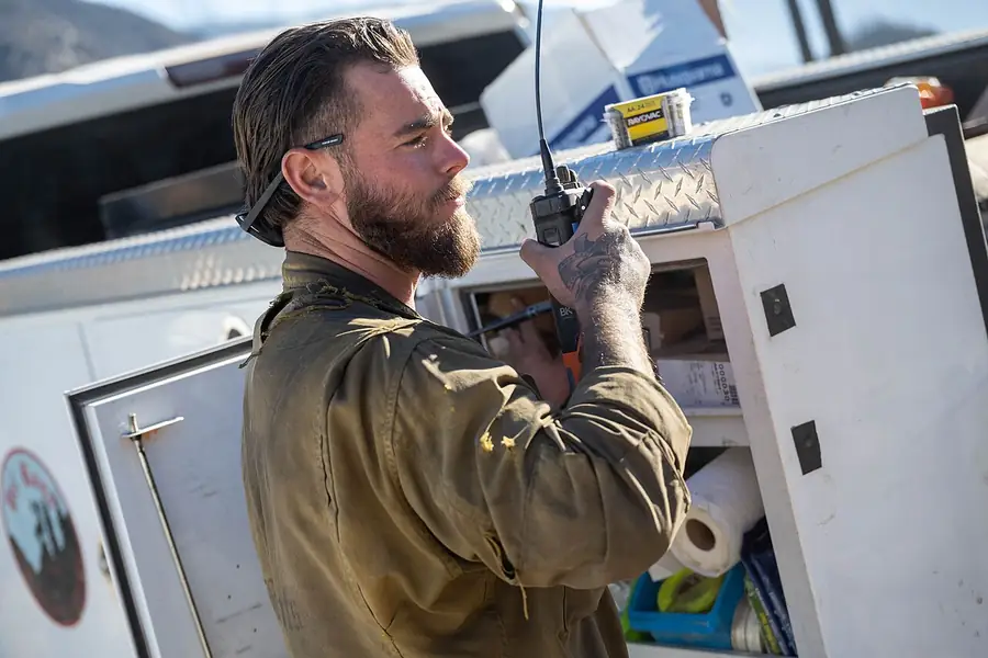
A wildland firefighter with his radioPeople

Homes, health and the front line

Firefighters risk their lives, residents lose homes, and smoke affects the health of people far away.

Every summer
evacuations across southern Europe
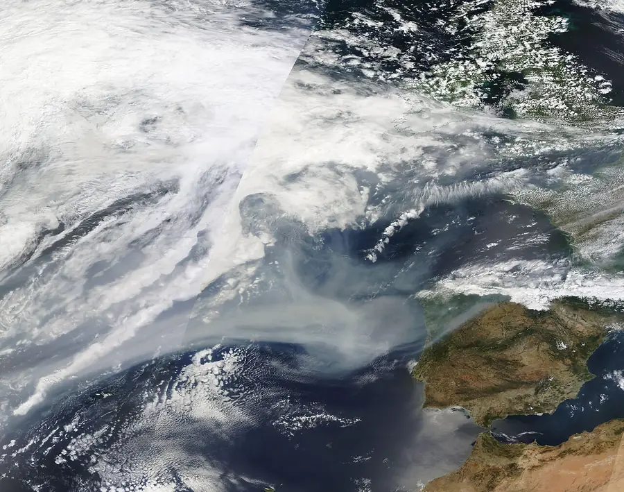
Satellite image of wildfire smoke drifting over the oceanAir and climate

Smoke crosses oceans

In 2023, smoke from Canada's fires reached Europe. Fires also release large amounts of CO₂.
1000s of km
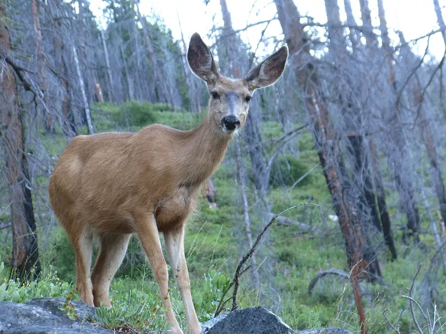
A deer among new green growth in a burned forestNature

Life comes back, slowly

Many forests recover, but when fires return hotter and more often, nature gets less time to grow back.
Decades
for a burned forest to mature again
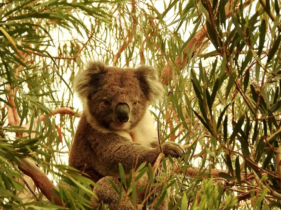
A koala that survived the Mallacoota bushfiresAnimals

Wildlife in danger

Nearly 3 billion animals were killed or displaced in Australia's 2019–20 bushfires.

≈ 3 billion
Our mission

Make every wildfire visible and understandable, worldwide and accessible to everyone.

Our vision: a world where no one is caught off guard by a wildfire, and where data, innovation and cooperation help prevent fires, limit the damage and protect people, nature and animals.

  1. 1
    CompleteSatellite detections, weather, wind, firefighting aircraft and news, brought together on one map. So you get the complete picture: you see where it is burning, understand what is happening and gain insight into the impact on people, nature and animals.
  2. 2
    Quality firstWe work on the quality of our data every day. We check every report, name our sources and enrich satellite detections with weather, news and official reports. So what you see is as complete and up to date as possible, clearly explained in your own language.
  3. 3
    InnovativeWe use the latest technology, from satellites to smart analysis, to spot fires sooner and understand them better. And we keep searching for new techniques and features, together with partners who want to move forward as much as we do.
  4. 4
    Always evolvingWatch Fire gets better every week. Every step brings us closer to our goal: protecting people, nature and animals, and preventing the next fire.
Always improving

We keep building. And we'd rather do it together.

Recently added

Watch Fire grows every week, based on what users and partners ask for.

  • Weather and wind risk on the mapSeptember 2026
  • Quick updates on major firesSeptember 2026
  • Read in your own languageSeptember 2026
  • Worldwide fire discovery2026

Working on preventing wildfires?

We look for partners who innovate, and for anyone who wants to help find solutions for society. Together we turn data into prevention, faster help and better decisions.

Sensors, drones and AIResearchEmergency servicesAid organisationsMunicipalitiesClimate tech
Support us

Help keep Watch Fire available to everyone

Share your experience

Your experience helps us move forward. Tell us what you like, what could be different or better, and what you would love to see next. With every reaction, we make Watch Fire even more valuable, together.

Rate us

Share from the ground

Seen a fire? Add a photo or video and help others understand what is happening.

Add photo or video

Partner with us

Data, technology, research or reach. Let's see what we can do together.

Donate or sponsor

Your support powers new features and keeps Watch Fire running day and night, wherever in the world a fire breaks out. Together we warn people sooner and help protect nature and animals.

Support us
The map is live

Where are fires burning right now?

Open the live map